


Maintaining Service Continuity With the Right Tools —
Natural disasters seem to occur more often, and are increasingly severe. As a result, they have the potential to inflict greater damage on telecommunications infrastructure. During a 40-day period in the fall of 2017, 4 powerful hurricanes hit the US, and a major earthquake struck near Mexico City.
Unfortunately, many telecommunications service providers are not fully prepared for the next big threat. If they don’t prepare now, before the next disaster strikes, their customers are at risk of prolonged service outages when they need lifeline communications the most.
Maintaining service continuity requires advanced preparation. Fortunately, there are steps service providers can take to prepare for the next big threat, and a geographic information system (GIS) is a critical technology that can help in 3 areas: risk reduction, readiness, and response/recovery.
Service providers need to plan to create a more resilient network, and to improve organizational readiness in advance of the next disaster. Small steps taken now deliver benefits that help mitigate service interruptions and speed restoration in the future.
A key first step is identifying the threats that could impact networks and operations. While fires, hurricanes, tornadoes, and earthquakes, all pose threats, the ways they can disrupt telecommunications service vary. Understanding these threats, and how they can affect network performance, allows companies to develop plans to minimize damage and the impact on service.
Because many threats are unique to certain geographies, location is essential to predicting the most prevalent ones and for preparing accordingly. Figure 1 shows the historical hurricane tracks in the Atlantic.

Figure 1. Hurricane Storm Tracking
Naturally, areas of the southeastern US should expect network damage from hurricanes, tornadoes, and floods. Networks in other areas, such as the western US, face other threats such as wildfires and earthquakes. Coincidentally, in 2017, the fires in Napa, California, started the day after the year’s last hurricane hit Louisiana.
Preparing networks and organizations for hurricanes is quite different from responding to wildfires. Companies that cover large geographic areas can customize their emergency response programs to address the most likely regional threats.
Readiness: Maximize Resources
With some threats, like earthquakes or tornadoes, advanced warnings are not possible. However, with today’s extensive satellite coverage and modeling capabilities, paths of storms and even wildfires can be predicted within a fair amount of time.
This advanced notice can give service providers an opportunity to make final preparations. Telecommunications companies can’t move their networks, but they can reposition crews and critical resources so that they are out of harm’s way but in locations that can be accessed quickly once the threat has subsided. To make these adjustments and take advantage of this preparation time, companies need to have systems that can create maps that show the tracks of the approaching threats and assess their impact.
GIS technology was used to map the expected storm surge as Hurricane Sandy approached New York in October 2012. Overlaying the storm surge forecast on top of the wire center boundaries layer provided vital information on areas that could expect significant flooding (colored in dark blue in Figure 2). This information helped identify where personnel, vehicles, and restoration equipment, that were threatened could be repositioned. Once the danger subsided, crews, trucks, and equipment, were able to be quickly redeployed to repair damage and restore service.

Figure 2. Hurricane Sandy Storm Surge Forecast
Similar techniques have been deployed in other types of disasters, such as wildfires. GIS tools to model wind, terrain, vegetation, and other factors, help in predicting the fire’s path and in identifying threatened structures. Communications companies access the same feeds used by firefighters to monitor the fires progress, and then determine the location of fiber cable and radio towers that are in danger. Predicting the potential impact allows companies to develop contingency plans for rerouting traffic or positioning replacement equipment before service is interrupted, minimizing or eliminating outages.
Having tracked the approaching threat and positioned field crews so that they are out of harm’s way but close enough to respond when the danger has passed, the organization is as prepared as feasibly possible.
The Next Step: Activate the Response and Recovery Effort
After an event, the biggest challenge facing key decision-makers is assessing the magnitude of the network damage and service outages. This is vital information for prioritizing resources and beginning the response effort.
The network operations center collects alarm data on power and network failures, but these are only part of what decision-makers need. When Hurricane Harvey flooded the Houston area, the telecommunications network was severely impacted — but so was the community. Many houses were under water, and would not be inhabitable for the foreseeable future. Emergency responders needed mobile service restored quickly in these areas. Other neighborhoods lost service, but residents were not forced out of their homes. For these areas, not only mobile but also phone, data, and video, services were high on the list of priorities. Decision-makers needed to see the big picture so that they could marshal resources and effectively coordinate the response effort.
In the past, providing an accurate assessment would often require field visits. Today this data can be collected quickly with aerial and satellite imagery. When a tornado tore through Moore, Oklahoma, in 2013, predisaster imagery and valuable post-damage assessment imagery were provided by Civil Air Patrol within hours. Later, the Federal Emergency Management Agency (FEMA), first responders, and emergency personnel, collected valuable data on structure damage, mapping homes and businesses that had been tagged as uninhabitable. This information was uploaded and shared publicly.
Although the Moore tornado caused severe damage, it occurred in a relatively confined area. Larger events, like major storms with more far-reaching impact, might render obtaining aerial images impossible.
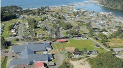
Fortunately, a new capability is now available and affordable: near real-time satellite imagery. Once the weather clears, high-resolution pictures of the affected area can be collected. This imagery can be used to create a swipe map. Figure 3 shows a swipe map of Hurricane Irma’s damage in the Florida Keys. The 2 images are synchronized, and provide a clear view of the ground and structures, with a slider bar that can be used to clearly view pre- and post-event imagery to assess the hurricane’s damage.

Figure 3. Storm Damage Swipe Map
The imagery with its network layer overlays is used to create damage assessment maps, and can be integrated into operational dashboards. This essential information is required for response and recovery efforts, and can be shared with the entire organization through maps and apps on mobile devices. From executives to field crews, everyone has a common operating picture.
GIS technology is extremely useful in helping organizations recover from major events, but it’s also applicable to minor service disruptions such as fiber cuts or equipment failure, which can be daily occurrences. Preparation that begins well before the event occurs reduces the downtime and the service impact experienced by your customers.
Preparing Your Organization
The best way to prepare for a major event is to gain knowledge about potential threats, and to identify available data sources before the threat occurs. Your journey to understanding potential threats should start with exploring sites that can provide information in an emergency.
Fortunately, there are publicly available sites that cover some of the most common and potentially devastating threats such as floods, earthquakes, and hurricanes. Here are a few public data sources worth exploring:
• Floods: https://msc.fema.gov/portal
• Earthquakes: https://earthquake.usgs.gov/data/products.php#sfbay
• Hurricanes: https://coast.noaa.gov/hurricanes/
To learn more about how you can prepare your organization for the next big danger, please visit the Esri Disaster Response Program site at http://www.esri.com/services/disaster-response.