Latest from C&E/NetDev Ops/GIS/Open-Source Networks
Leverage Different and Powerful Partnerships
If you want to understand the significance of the approaching 5G revolution, just consider the numbers. Over the next decade, 5G deployment could contribute up to $1.7 trillion to the US GDP and create about 4 million jobs, according to consulting firm BCG.1
In telecom, 5G isn’t just going to change the rules of the game, it’s going to take it to an entirely different playing field. Those who make the right investments now will realize an outsized share of future gains. But it takes a willingness to embrace a new mindset, new partners, and new technology.
GIS data, for example, has historically enabled telecom providers to plan routes and fiber networks. It’s an accurate way to map their above-ground and in-ground assets to make sure they have up-to-date information and unobstructed pathways. But in an era defined by 5G, telecom companies need to reimagine their networks to densify to the necessary degree. And that creates an even bigger opportunity for those who use GIS data—in the right ways.
5 Questions
As telecom leaders navigate this dynamic moment, a strong GIS strategy can help them grow. If you’re looking for a GIS partner, these 5 questions can help you find your match.
1. How Can You Help Me Succeed in a 5G World?
Think of it this way: in the mobile era of yesteryear, data traveled like sound waves. But in a 5G environment, data travels more like a light wave. That means line-of-sight matters more than building materials. It also means networks are in a race to deploy 100 times the number of 5G towers because 5G waves don’t travel as far and can’t pass through obstructions. To ensure both coverage and capacity, those towers need to go up all over, including in congested downtown areas.
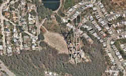
Old-school RF propagation tools may have been effective enough at planning networks in 3G and 4G environments. But newer GIS technology that offers aerial imagery and data insights is needed to meet the kind of density 5G demands.
2. Just How Fresh and Accurate is Your Imagery?
In a 5G universe, data that isn’t constantly updated and 99% accurate is irrelevant. Especially in an increasingly dense environment, providers need to know exactly what’s surrounding their assets—or potential assets—at all times. The only way to achieve that level of freshness is through a subscription GIS service that’s uploading new data all the time. The ideal GIS partner publishes fresh imagery of our coverage areas in the cloud multiple times a year, so customers always have an up-to-date view of what’s truly on the ground.
One company, Nearmap, ensures that data is accurate within ⅛ of a cm, which ensures telecom companies know exactly which poles have space to mount gear and where exactly those poles are located.
3. Can You Support Me Through a Crisis?
Getting a network up and running is just the first step. What makes the difference between winners and losers is maintenance. As savvy telecom leaders know, customers who can’t get service in a hurricane or natural disaster switch to someone else. And in a 5G-dominated world, even a single wet leaf can disrupt a signal.
In a disaster, continually updated and highly accurate GIS data ensures that telecom providers can swiftly deploy crews to make necessary repairs and fortify the network.
4. How Intelligent are Your Insights?
As the role for GIS evolves, so must its intelligence. Artificial intelligence (AI) can enhance datasets with oblique images from different angles to see obstacles or support planning for routing. AI datasets can also provide supplementary information, from identifying information for poles and buildings to the site of buildings, square footage, and other key details. With AI, GIS partners can get key insights to you faster and in a format that automatically augments and complements your existing data.
5. How do You Ensure Safety and Compliance?
Finally, as companies continue to grapple with pandemic-induced disruption, any partner that can’t help you adhere to the highest public health and compliance standards is remiss. For the foreseeable future, sending feet into the field isn’t just inefficient—it can be unsafe.
New GIS technologies make it easier than ever to get high-resolution data virtually. Remote options not only help you stay on top of the data you need in a less time- and labor-intensive way. They also ensure safety, which helps attract and retain the best talent.
Making the most of a rapidly changing opportunity is never easy—and in the midst of an ongoing global crisis, no less—but those who lean into transformation now will define the telecom landscape of tomorrow. GIS technology can be a powerful driver of future success—as long as you pick the right partner.
Resources And Notes
1. https://www.bcg.com/en-us/publications/2021/5g-economic-impact-united-states
For more information, visit https://www.nearmap.com/us/en. You can also follow us on Twitter: https://twitter.com/nearmap.


