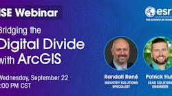
September 22, 2021 @ 1:00 pm – 2:00 pm
Webinar Recorded on Wednesday, September 22, 2021
In today’s connected world, having access to reliable broadband networks is essential for all. However, throughout the world, a high percentage of people lack access to broadband at minimally accepted speeds. To address this issue, telecommunications organizations are working as fast as possible to tackle the challenge and building the necessary networks needed for bridging the digital divide and connect both rural and underserved communities.
In order to address these challenges as efficiently as possible while maintaining fiscal responsibility, network scalability, and consumer transparency, telecom organizations need a foundation for intelligent decision-making before taking action in managing their networks. Esri’s ArcGIS® provides a scalable, agile, and modern system of geospatial tools and resources to help companies achieve their goals. Take comfort in knowing this is an arena we have decades of experience in, and we’re here to help your organization.
Whether you’re applying for broadband grants, working to identify areas of no service or underserved locations within your existing region, or have recently obtained the funding needed to build out a broadband network and want to maximize capital investments, every aspect of your task at hand involves location and geography. Esri is the global leader in geographic information system (GIS) technology and can support you in your efforts. Since building a broadband network consists of a tremendous amount of location-based data, this is where GIS excels. It is uniquely suited to help your organization bid, plan, design, construct, and operate networks — all while meeting various reporting obligations associated with funding applications and awards.
As the global leader in geospatial products and services, we can empower your organization to make the best decisions possible as you take on the tasks associated with connecting the community. For decades, Esri has been successfully helping Telecom and Cable providers of all sizes leverage the power of geospatial data through ArcGIS. ArcGIS is a comprehensive GIS consisting of a system of record, system of insight, and system of engagement. ArcGIS provides a wide variety of resources, tools, applications, and solutions to help organizations solve many challenges.
Our team knows the challenges associated with planning, designing, engineering, constructing, and delivering telecommunications networks to customers as quickly as possible while maintaining the highest level of fiscal accountability, documentation, and insight. Based on our observations and experience in the industry, whoever applies for or receives grants or loans will need to do the following:
- Quickly plan and detail proposed networks and scope project costs.
- Design and engineer proposed networks, including high-level walkout surveys.
- Construct the network while both monitoring and reporting progress internally and externally.
- Provision new customers and operate the network.
- Maintain authoritative and up-to-date documentation on the network throughout its life cycle.
Through integration of your organization’s existing data and information, such as network designs, customer records, construction project records, and city and landscape assets, you build your GIS into a powerful foundation supporting intelligent decision-making, streamlined processes and workflows, transparency and collaboration in communication, and real-time situational awareness.
Webinar Recorded on Wednesday, September 22, 2021
Presented by:
Randall René, Industry Solutions Specialist – Telecommunications & Cable, Esri
Randall René is an Industry Solutions Specialist for the Telecommunications industry at Esri. He brings a love of mapping, efficient process design, change management, and over 20 years of experience in the telecommunications and cable industry. Randall has worked in a wide variety of positions throughout his career. He’s worked as a field tech, built and maintained central offices, led infrastructure planning and design teams, and helped lead GIS innovation and application development. When he’s not working, you can find him volunteering in the community or enjoying outdoor activities.
Patrick Huls, Lead Solution Engineer – Telecommunications & Cable, Esri
Patrick is a Senior Solutions Engineer for the Telecommunications industry at Esri. He is responsible for understanding the technology needs of the telecom market, helping organizations with their geospatial strategy, and ensuring customer success with GIS. Prior to his work at Esri, he was a GIS Analyst with a consulting firm that worked closely with large utility, construction, and engineering firms on utility and telecom construction projects. There, Patrick designed and built an enterprise-wide location platform which incorporated server, desktop, web, and mobile components.
Founded in 1969 in Redlands, California, USA, Esri software is deployed in more than 350,000 organizations globally and in over 200,000 institutions in the Americas, Asia and the Pacific, Europe, Africa, and the Middle East. Esri has partners and local distributors in over 100 countries on six continents, including Fortune 500 companies, government agencies, nonprofits, and universities.
With its pioneering commitment to geospatial information technology, Esri engineers the most innovative solutions for digital transformation, the Internet of Things (IoT), and advanced analytics. To find out more about how ArcGIS can help your organization, please visit www.esri.com/telecommunications


